


Guan Lide software introduction
管立得2018是鸿业科技CIVIL系列产品的拳头产品,经过鸿业人二十多年的深耕细作,已经成为公司的明星产品,更是用户手中的的设计利器,深受用户认可,市场占有率一直稳居高位。 Guan Lide 2018 continues to deepen the design on the basis of Guan Lide 11.0. The return design takes users as the fundamental starting point, focuses on users, respects user experience, and is simpler, smarter, and more flexible!
Guan Lide function introduction
1. Three-dimensional
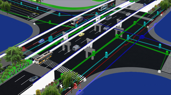
The pipeline adopts a two-dimensional and three-dimensional integrated design method. In the plan view, the pipeline is displayed in two-dimensional mode. By changing the perspective, the pipeline is displayed in three-dimensional mode. You can intuitively view the relationship between the pipeline and the surrounding terrain, features, and buildings.
2. Terrain, roads, general map
The software fully considers the close connection between pipeline design, road design, and general plan design. It can automatically utilize the design results of Hongye Road and Hongye General Plan, and can also quickly transform and identify the design results of related products of other companies. It also provides a complete topographic map recognition function.
3. Graphic design
Based on the respective characteristics of pipelines and the characteristics of roads, a combination of automatic alignment and interactive alignment is used to quickly obtain the pipeline layout plan. For the original planning diagram, you can also use the define pipeline function to define the existing pipelines in the planning diagram into corresponding pipelines. For water supply pipelines without roads and rainwater and sewage pipelines that discharge to water bodies, the concept of pipeline pile numbers is introduced in the software, and the design can be based on pipeline mileage piles.
4. Pipeline calculation
Including professional calculators for rainwater and sewage system calculations and water supply and drainage pipes. When calculating rainwater and sewage pipes, designers can set their own constraints: fixed pipe diameter is calculated as slope, fixed slope is calculated as pipe diameter, fixed pipe diameter and slope, slope and pipe diameter are calculated by the program, etc. Storm and sewer pipe calculations support lift pump stations and double pipes. All calculations can generate detailed calculation books (txt, excel, word format). Automatically find and calculate catchment areas, and automatically associate catchment area parameters with inspection wells. Calculate sewage flow based on catchment area, population density, per capita drainage standards and total change coefficient. Different runoff coefficients can be used for each catchment area. According to the specific design conditions, different rainfall return periods are set for main pipes, branch pipes, etc.
5. Vertical design
The elevation of various pipelines is automatically determined based on the set pipeline priority, pipe top covering soil, pipeline net distance, and pipeline control elevation.
6. Longitudinal section view
Various pipeline longitudinal sections can be automatically drawn based on the plan view according to the length of the road centerline, the length of the pipeline, the projected length of the pipeline in the X direction, etc. It is also possible to draw a unified horizontal and vertical section view, and combine rainwater and sewage pipes to draw a combined longitudinal section view of rainwater and sewage pipes.
7. Detailed drawing of water supply node
It includes two methods: automatic node detail drawing and assembly node detail design. Pipe fittings can be drawn in the material table.
8. Drawing annotation
The drawing annotation includes coordinate annotation, pipeline annotation, node annotation, well pipe annotation, pipeline comprehensive cross annotation, etc. The above annotations can be automatically completed by the program, and the annotation forms and methods are diverse to meet the needs of different users.
9. Pipe network adjustment
Water supply pipe network adjustment includes the entire adjustment calculation process including node flow calculation definition, pipe diameter calculation definition, pipe network adjustment, and adjustment result labeling. During adjustment calculation, the water source can be constant pressure or a combination of water pumps. It can calculate any number of water sources, and can calculate various working conditions such as the most unfavorable point check, fire check, back-calculation of water source point pressure, accident check, and maximum transfer. The original calculation data can be input directly or automatically extracted from the drawing. The calculation scale reaches thousands of pipe sections, and the calculation results can be marked on the drawing, or a complete adjustment calculation book can be formed. The water supply area can be displayed and the isobaric lines of the pipe network can be drawn.
10. Pipeline comprehensive
Pipeline settings are flexible, all types of pipeline layers and node libraries are complete, and it is open to users. Quickly draw various pipelines, trenches, trenches and pipelines, etc., dynamically and intuitively perform vertical collision analysis and adjustment of pipelines, automatically draw pipeline cross-section diagrams and intersection vertical distance tables, and the intersection annotation content is diverse and clear.
11. Statistical tables
It can automatically draw material tables, legend tables, drawing catalogs, inspection well tables, earthwork calculation tables, and automatically draw pipeline excavation cross-sections.
12. Drawing tools
自动进行平面分幅出图、纵断面分幅出图。 Thematic maps of water supply pipes, sewage pipes, rainwater pipes and other pipes can be quickly formed through professional layer management.
Guan Lide new version features
1. New highlight functions
1. Newly added: The new modular installation and startup method creates a platform-based design concept. The software interface is divided into water supply pipe network design, drainage pipe network design, gas pipe network design, heat pipe network design, and power and telecommunications pipe network design. Each has an independent menu, and you can switch between modules at will.
2. Newly added: Pipeline transfer function realizes online transmission of pipeline data. During the design work, the pipeline data can be transferred to relevant personnel at any time. After receiving the data, the relevant personnel can immediately draw it into the design drawings to facilitate viewing of design results, design changes, collision detection and other work.
3. Newly added: Online map function, easy to obtain terrain elevation data and terrain image data in the design area, to assist design,
Design work is easier.
4. Newly added: The node diagram management function, based on the original automatic generation of node diagrams, adds the function of storing and calling existing node diagrams. The diagrams automatically match, filter, and count the diagrams, making it simpler, smarter, and more flexible!
5. Newly added: Improve the municipal electrical pipeline network design module. Added functions such as street light design, adjustment, load calculation, and load statistics.
6. Newly added: The old version of the software can recognize the new version of drawings, breaking the incompatibility barrier between old and new drawings. Guan Lide 2018 Starting from now on, drawings will no longer distinguish between software versions, and drawings designed by various software versions will be compatible and identifiable with each other.
7. Newly added: Supports exporting pipeline data to excel files, and exported data items can be customized to add or delete, and the order of data items can be customized. Supports generating single or multiple sheets based on piping system type Page.
8. Newly added: Added the function of identifying status management, improved the function of identifying DWG status map, added user-defined configuration function, users can customize the current situation according to the actual DWG In the case of the current status diagram, it matches the corresponding extended data items or attribute fields, etc., and is compatible with more forms of DWG status diagram recognition.
2. Conditional diagram preparation
1. Newly added: The chainage definition supports broken links, and can automatically identify the chainage lines containing broken links generated by Lulide software; pipeline layout, longitudinal section drawing, etc. all support broken chain chainage and elevation files.
2. Repair: After the structures along the road are set up, the station numbers and specifications marked on the longitudinal sections are incorrect.
3. Improvement: The terrain surface extraction elevation file supports pipeline station numbers.
3. Pipeline design
1. Newly added: Pipes with different pipe codes in the same system support intersection without interruption. This can be achieved by setting the parameter item "No" in [System Settings]-"Default Parameters"-"Automatic Connection of Different Pipe Codes".
2. Newly added: Modify the basic pipeline function, which can quickly modify the basic data of the pipeline in batches.
3. Newly added: The function of repairing the pipeline system can repair the problem of unrecognized pipeline data caused by the loss of the pipeline system.
4. Repair: On the branch official website, if the main line and the branch line both define pipe station numbers, the intersecting nodes will use the later defined station numbers, resulting in a station number error when the first defined station number path exits the pipeline mileage pile section.
4. Vertical
1. Optimization: The speed of determining the well surface elevation is greatly improved when using the Lulide model method to define it.
2. Improvement: Define the node ground elevation and add the "design elevation is the same as the natural elevation" option when defining the natural elevation.
3. Repair: When defining the node ground, there is a pipeline station number, and only the bgz file can be selected for both the design elevation and the natural elevation. Design elevation can be selected bgs file
4. Newly added: The municipal electrical module adds the function of "defining wellbore and well chamber height", which can define the wellbore and well chamber height for electric power inspection wells, and mark the longitudinal section.
Guan Lide update log
1.Fix BUG, the new version has a better experience
2. Some pages have been changed
Extraction code: u774
Huajun editor recommends:
The editor promises that as long as you use Guan Lide, if you don't like it, you can come and hit me! The editor has also prepared for youDutt door and window master,vect2000 vectorization software,Show me my house,3D piping design software,GeoCorelDRAW


Your comment needs to be reviewed before it can be displayed