


LocaSpace Viewer software features
We share Internet map resources to create a more exciting tomorrow, with fast browsing speed and no need to go over the *wall.
The official version of LocaSpace Viewer integrates a variety of online map resources, including Google Earth images, Google Earth terrain; Baidu maps, images, annotations; Tiantu maps, images, annotations and Microsoft maps, images, annotations. The software also provides a local map source interface to easily access various types of external image sources.
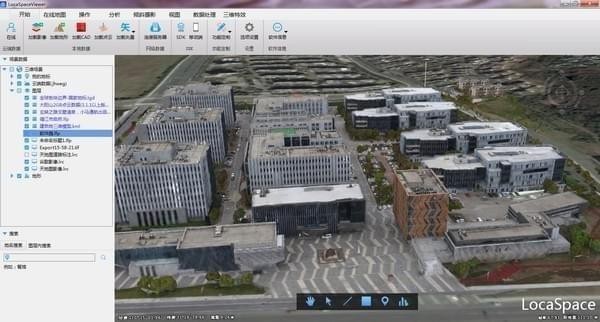
The fast indexing and browsing technology of oblique photography models achieves truly powerful all-element spatial measurement and single functions in seconds.
LocaSpace Viewer (LSV) supports extremely fast browsing of oblique photography data. Supported oblique photography 3D model formats include *.osgb, *.dae, etc. The software indexes the osgb block file to generate an lfp file, which facilitates the rapid positioning of the oblique photography 3D model on the earth.
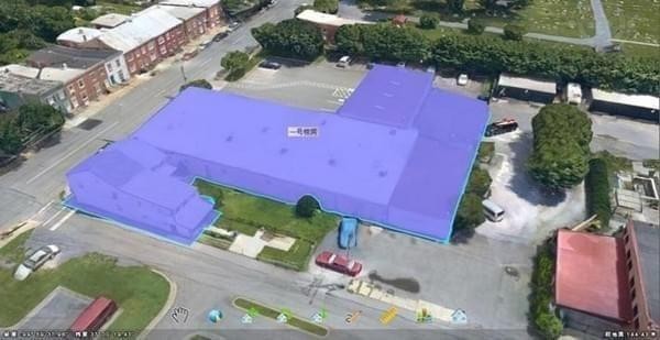
LocaSpace Viewer (LSV) uses vectorization to realize the single unitization of buildings, roads and other ground objects at the rendering level through superimposed vector bases.
LocaSpace Viewer software introduction
LocaSpace Viewer is a practical and fun 3D GIS software
Supports all types of 2D and 3D data, covering a variety of featured applications.
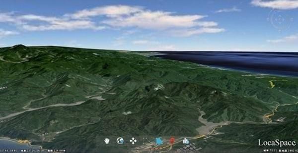
LocaSpace Viewer (LSV) can take you to fly and roam anywhere on the earth. You can see the undulating mountains and sparkling oceans.
You can load and analyze your two-dimensional vector, raster data, three-dimensional terrain, and three-dimensional model data on LocaSpace Viewer (LSV), making the data no longer abstract.
The official version of LocaSpace Viewer can fully participate in the early planning, field data collection, in-house production, and data release in the operation process, making it a convenient and practical 3D GIS platform. Tools have always been our goal.
LocaSpace Viewer update log
1. Optimized some functions
2. Solved many intolerable bugs
Huajun editor recommends:
LocaSpace Viewer has always been a commonly used astronomy and geography tool for most netizens. Its dominant position in the minds of netizens can be seen. It is strongly recommended that users download LocaSpace Viewer and use it. Come to Huajun Software Park to download it. In addition, there areGoogle Earth Chinese version,Hydrological Frequency Intelligent Analysis System,China high-speed rail map 2018 HD version,KStars,OpenCPNAvailable for download.


Useful
Useful
Useful