If you are looking for software to use, go to Huajun Software Park! software release AI product list

Hello, if there is a need for software inclusion, please package the software and attach the software name, software introduction, software-related screenshots, software icon, soft copy, business license (if you do not have a business license, please provide the front and back of the corresponding developer ID card and a photo of yourself holding the ID card), and send it to email http://softwaredownload4.com/sbdm/user/login

Close >>

Send to email:news@onlinedown.net

Close >>

Location: Home pagePC softwareNetwork softwareBrowse offline China National Basic Topographic Map Query Software
China National Basic Topographic Map Query Software

China National Basic Topographic Map Inquiry Software Official Version

QR code
  • Software licensing: free software
  • Software size: 0.12MB
  • Software rating:
  • Software type: Domestic software
  • Update time: 2024-12-30
  • Application platform: Win All
  • Software language: Simplified Chinese
  • Edition: Official version

Download the service agreement at the bottom of the page

Software introduction Related topics FAQ Download address

Basic introduction
China's national basic topographic map query software segment first LOGO
The official version of the China National Basic Topographic Map Query Software is a multi-calculation function designed and compiled in accordance with the National Standard of the People's Republic of China GB/T 13989-92 "National Basic Scale Topographic Map Framing and Numbering" and the old series of basic topographic map framing standards. It is mainly used to provide a simple calculation tool for the search and calculation of map sheets and the inclusive relationship between map sheets. Based on his own work experience and the actual needs of users, the author has spent many years painstakingly developing a set of system tools common to mapping, mapping and other map-related departments, which can provide complete query solutions for relevant users.

Screenshot of China’s national basic topographic map query software

China National Basic Topographic Map Inquiry Software Software Description

Based on the concept of "practical, simple and fast" and putting ourselves in the shoes of users, this system not only provides powerful and flexible functions, but also has strong fault tolerance, low system requirements, friendly interface, and simple operation. All this is because we strive for perfection and make work easy and fast. All development of China's national basic topographic map calculation software is inseparable from everyone's support and help, and every bit of progress is due to everyone. In the future, China's national basic topographic map calculation software will be proactive and innovative based on the needs of users, and provide users with more complete and excellent services.

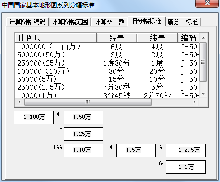
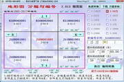
Various calculations of the software include topographic maps at eight basic scales: 1:1 million, 1:500,000, 1:250,000, 1:100,000, 1:50,000, 1:25,000, 1:10,000, and 1:5000.

Screenshot of China’s national basic topographic map query software

Automatic identification and calculation of old and new drawing numbers.

Main functions of China’s national basic topographic map query software

A. The drawing number of the series of scales where the calculation point is located;

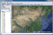
B. All pictures containing a certain scale within the rectangular range of longitude and latitude;

C. Frame parameters of any ellipsoid parameters of Gauss-Krüger projection;

D. Exchange old and new drawing numbers;

E. The mutual inclusive relationship between topographic maps of different scales.

Screenshot of China’s national basic topographic map query software

How to use China’s national basic topographic map query software

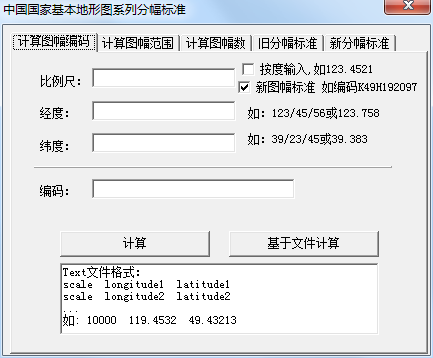
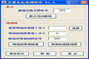
How to calculate frame encoding?

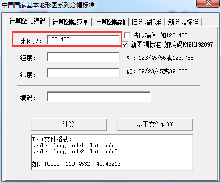
1. Run the software and enter the calculation frame encoding interface.

Screenshot of China’s national basic topographic map query software

2. Enter the scale

Screenshot of China’s national basic topographic map query software

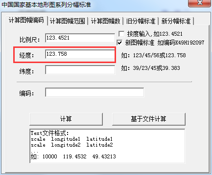
3. Enter the longitude

Screenshot of China’s national basic topographic map query software

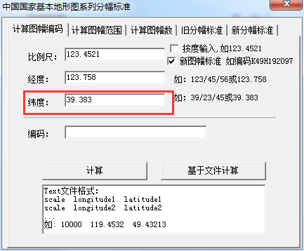
4. Enter the latitude

Screenshot of China’s national basic topographic map query software

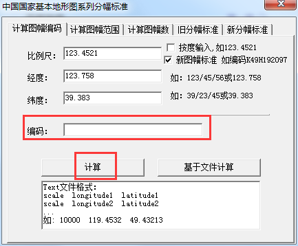
5. Enter the code and click Calculate

Screenshot of China’s national basic topographic map query software

Frequently Asked Questions of China National Basic Topographic Map Inquiry Software

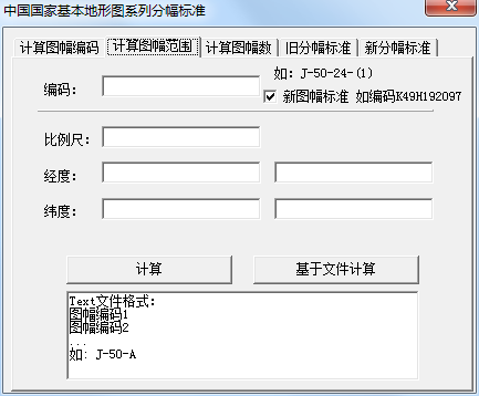
  How does the official version of the China National Basic Topographic Map Inquiry Software calculate the map range?

Click Calculate the map range on the official moderator interface of the China National Basic Topographic Map Inquiry Software, enter the code, scale, longitude, and latitude, and click Calculate.

China National Basic Topographic Map Inquiry Software Update Log

Working day and night just so you can be happier

Mummy, Mummy, coax~all the bugs are gone!

Huajun editor recommends:

After continuous official improvements, the China National Basic Topographic Map Query Software can meet all your needs. Come download and experience it. Of course, this site has also carefully prepared for youBIGEMAP one-click offline map publishing tool

FAQ

China National Basic Topographic Map Query Software

China National Basic Topographic Map Query Software Official Version

close