- Green versionCheck
- Green versionCheck
- Green versionCheck
- Green versionCheck
Software features
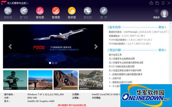
"Drone Manager" is a one-stop intelligent GIS system for UAV data acquisition, processing, display management and UAV maintenance, including support for a wide variety of flight platforms such as fixed wings and rotors, and routes that meet various application needs. mode, accurate 3D route planning that supports true 3D terrain data, 3D real-time flight monitoring, fast flight quality inspection, rich data processing toolbox, robust precision control and automatic mapping, rich 4D+3D result types, and visual monitoring center, as well as system upgrades, intelligent maintenance, information push and other cloud services.
1. Intelligent route: three-dimensional route planning makes the design simple and reliable
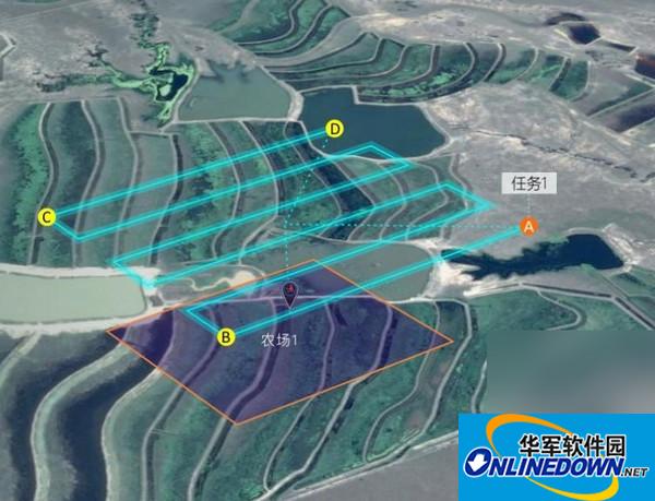
"Intelligent Route" is a route planning software for fixed-wing and rotary-wing UAVs. It can automatically generate the best flight plan and route for post-processing based on high-precision real-life three-dimensional terrain according to the terrain fluctuations and image requirements of the mission area, and can also handle extremely large Task areas are automatically divided and managed to ensure post-processing edge connection needs.
Automatic routes to meet various application scenarios
According to aerial photography parameters such as the scope of the mission area, terrain relief, image resolution, camera model, overlap requirements, etc., the optimal mission route adapted to different terrains is automatically generated based on elevation data, and supports strip routes, frame routes, tilted camera routes, Rotor panoramic routes, rotor surround 3D modeling routes, etc.
2. Intelligent flight: real-time three-dimensional presentation of flight status
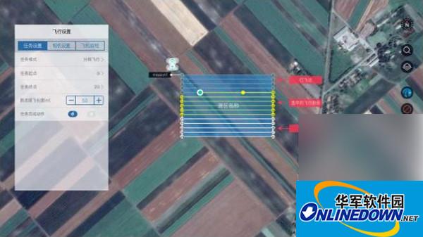
"Intelligent Flight" is a UAV flight monitoring software that can visually monitor flight status and parameters in real-time three-dimensional scenes, modify flight status, and provide intelligent early warning to ensure the safe execution of flight missions; with "Processing Project" as a virtual sortie, according to Acquire single flight data based on actual field conditions, and automatically continue flights through the software to complete area-wide coverage and improve internal and external industry efficiency.
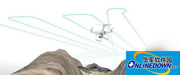
1. Supports unified interface monitoring for fixed-wing, rotary-wing and other aircraft types, supports different modes of aerial video monitoring, and supports multiple sensor operations.
2. Support three-dimensional scenes and three-dimensional visualization of flight trajectory status to enrich user monitoring information and improve monitoring quality.
3. Real-time visual display of aircraft trajectory, aircraft status, wind speed and ground speed, battery status, onboard temperature and GPS positioning status parameters.
4. Supports intelligent alarm for abnormal flight conditions and one-click return function.
5. Visual playback of the entire flight process.
6. Guided interface design allows beginners to easily and quickly complete the preparations before taking off.
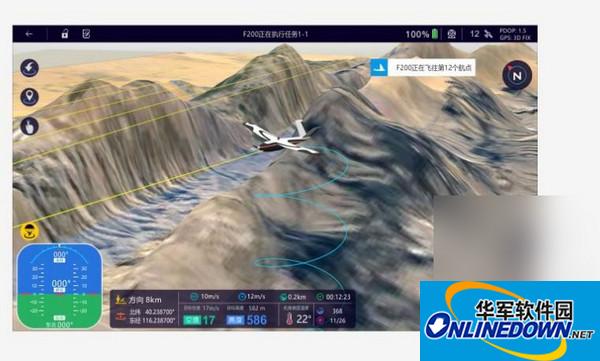
3. Intelligent inspection map: flight data and quality reports are clear at a glance
"Intelligent Inspection Map" is an automated software professionally used for on-site inspection and assessment of aviation quality. It can quickly obtain aviation quality reports and improve the efficiency of the UAV data quality inspection process and the reliability of post-processing.
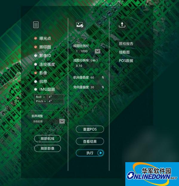
1. The degree of automation is high, and aerial survey data quality inspection can be completed with one-click operation. No professional aerial survey background is required, and it can be mastered with simple training.
2. Based on the GPU parallel computing mode, it only takes 5 to 10 minutes from image input to final quality inspection report output, making it easier for flight personnel to promptly discover aerial survey problems and take countermeasures.
3. Provide professional quality inspection reports of UAV data. Its graphical output results and indexed statistical files provide reliable basis for flight quality evaluation.
4. It can display a variety of information such as image exposure points, footprints, posture overruns, image connection strength, etc., making it easier for users to view data quality from multiple angles.
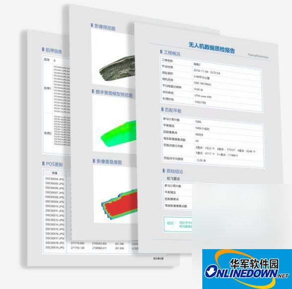
4. Intellectual graph: rich drone data processing toolbox
"Intelligence Map" is a UAV data preprocessing software that provides advanced flight calibration and distortion removal tools, post-differential GPS data processing tools, automatic layout of control points based on terrain and other tools to meet the high precision of UAVs. Surveying and mapping requirements. In addition, it also provides pre-processing functions such as image light and color uniformity, enhancement, pyramid creation, and format conversion.
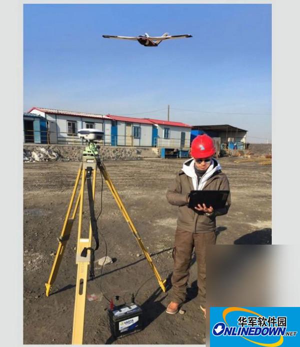
1. Advanced camera calibration and distortion removal functions: supports two calibration methods: ground calibration field and aerial flight data, and supports lossless precision import of common domestic camera calibration models, image distortion removal, etc. to ensure later aerial triangulation solution Seamless connection with stereo mapping.
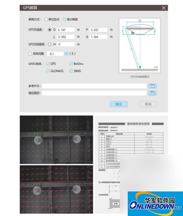
2. Post-differential GPS data processing: supports one-click differential GPS data calculation based on PPK, and can customize antenna models, supports joint calculation of GPS, Beidou and other satellite data, supports standard RINEX format data import, and system eccentricity correction etc. to ensure high accuracy of processing results.
3. Control point layout: Based on UAV aerial survey specifications, hardware positioning accuracy and survey area terrain conditions, the optimal layout plan is automatically generated, and manual adjustment and plan import into mobile devices are supported.
4. Result image release: Based on the result image, tile data that conforms to Google standards is output, and supports online publishing on mobile terminals.
5. Intelligent Jigsaw: High-precision and fast full-result processing software
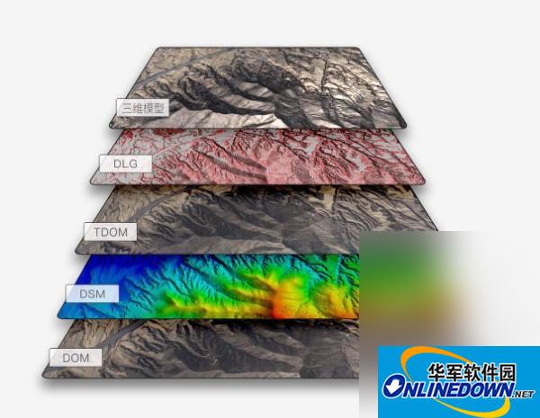
"Smart Jigsaw" is a one-click drone data processing software. It can complete the entire process of UAV data from orthographic and oblique aerial triangulation, adaptive feature matching, control point measurement, orthorectification, uniform color mosaic, full-pixel high-density point cloud matching, true radiography, and 3D reconstruction. , can output traditional DEM and DOM, and also supports the output of high-precision, high-quality DSM and tDOM and real-life 3D models. It also supports intelligent measurement of control points, GPS-assisted aerial triangulation, direct PPK mapping without control data, and quick browsing of 2D and 3D data.
1. Powerful core algorithm: supports orthophoto and oblique matching and aerial triangulation solution, can easily deal with irregular image arrangement, large declination angle, irregular overlap, etc., and is compatible with various cameras, terrains, weather and environments. Image data.
2. Powerful processing performance and rich result types: Drone Manager Professional Edition supports simultaneous processing of up to 10,000 images, and supports fast dense point cloud, real shots and real scene 3D result types.
3. Intelligent control point measurement, GPS-assisted airborne triangulation greatly reduces field work: UAV Butler control point measurement supports manual measurement and automatic measurement, and provides a robust GPS-assisted airborne triangulation algorithm to ensure minimal control The accuracy of mapping control under point conditions improves the efficiency of large-scale UAV applications.
4. Multi-parameter aerial triangulation algorithm based on differential GPS to realize high-precision direct mapping without control: Based on differential GPS-PPK high-precision solution and advanced multi-parameter aerial triangulation algorithm, realize high-precision direct mapping of Pegasus UAV without control Directional mapping to meet data acquisition requirements in difficult and dangerous areas.
6. Intelligent monitoring: drone flight is under control
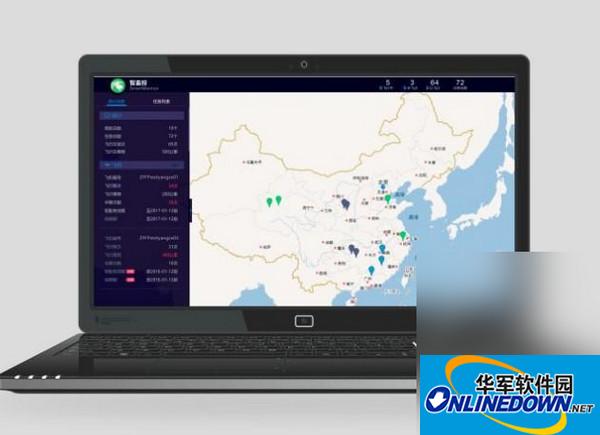
"Intelligent Monitoring" is a special module of Drone Manager, which provides the functions of visual statistical playback of the flight process, flight record analysis and display summary.


it works
it works
it works