GPS tester highlights
outdoor sports
Hiking: Use compass and track tracking to avoid getting lost and record the route.
Cycling/Running: Monitor speed in real time and analyze sports data.
travel adventure
Navigation in unfamiliar areas: Combine maps and satellite data to ensure accurate routes.
Day and night judgment: Plan your itinerary in advance to avoid accidentally entering dangerous areas at night.
daily commute
Real-time speed monitoring: avoid speeding and improve driving safety.
Map location query: Quickly find surrounding businesses, bus stops, etc.
Professional application
Geographical survey: Measure land area, route distance.
Magnetic field analysis: detects abnormalities in environmental magnetic fields.
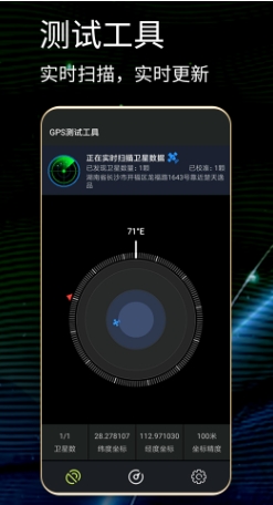
GPS tester features
High-precision positioning
Scan and calibrate GPS satellites in real time to ensure accurate longitude and latitude data.
Supports multiple coordinate formats (such as degrees, minutes, seconds, decimal) to meet different user needs.
Multifunctional integration
Compass + speedometer + map + magnetic field detection four-in-one, covering outdoor adventure, city navigation and other scenarios.
The track tracking function can record the journey and is suitable for sports analysis such as hiking and cycling.
User friendly design
The interface is refreshing and intuitive, and the operation is convenient. Even novices can get started quickly.
Support Chinese interface and lower the language threshold.
Utility extensions
The route measurement and area query functions are suitable for professional scenarios such as geographical surveying and land planning.
Magnetic field detection can assist in survival in the wild or troubleshooting interference from electronic equipment.
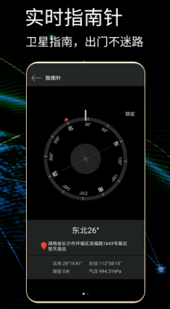
GPS tester function
Real-time positioning and satellite monitoring
Latitude and longitude display: Provides the latitude and longitude coordinates of the current location in real time.
Satellite status: Displays the number of available GPS satellites, signal strength, and azimuth angle, and supports automatic calibration to ensure data accuracy.
Navigation and Direction Tools
Compass function: The interface is simple, pointing south in real time, and supports outdoor scenes such as mountain climbing and hiking.
Speed monitoring: Real-time display of moving speed (such as driving, running, walking).
Track and map tools
Track tracking: record and retain historical tracks, support export or sharing.
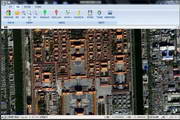
Map location query: Call the Amap open platform map to display the current location and surrounding information.
Route measurement: Measure the straight-line distance between any multiple points on the map.
Area query: Calculate the area size of the marked shape on the map.
Environmental detection tools
Magnetic field detection: Real-time display of current magnetic field strength.
Day and night judgment: Automatically judge whether it is day or night based on geographical location.
Time zone and time: Display local time zone time and UTC time.
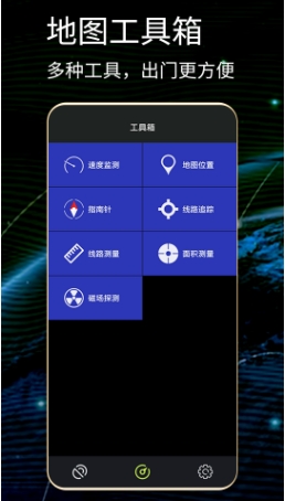
GPS tester FAQ
Problem: Positioning is inaccurate or the number of satellites is displayed abnormally
Reason:
The device is located indoors or in an area with many obstructions.
The GPS module is not calibrated or has signal interference.
Solution:
Move to an open area and wait for the satellite signal to stabilize.
Restart the app or device and recalibrate the GPS.
Problem: Compass points wrong
Reason: There is strong magnetic field interference around the device.
Solution: Stay away from magnetic objects (such as magnets, electronic devices) and recalibrate the compass.
Problem: Track records are lost
Reason: The storage permission is not turned on or there is insufficient storage space.
Solution: Check the permission settings, clear the storage space and try again.
GPS tester update log:
Sweep the bug out and carry it out to the end
Optimize user feedback issues and improve detailed experience
Huajun editor recommends:
The GPS tester is one of the best software in the industry. I believe many friends will have used it. If you don’t use it anymore, you will be OUT. This site also prepares for youAotu Car Rental,Google Earth 2021,Tantu offline map,Xingruan Auto Link,360 search map


 You may like







Your comment needs to be reviewed before it can be displayed