If you are looking for software to use, go to Huajun Software Park! software release

Hello, if there is a need for software inclusion, please package the software and attach the software name, software introduction, software-related screenshots, software icon, soft copy, and business license (if you do not have a business license, please provide the front and back of the corresponding developer ID card) and a photo of yourself holding your ID card) and send it to your email address http://softwaredownload4.com/sbdm/user/login

Close >>

Send to email:news@onlinedown.net

Close >>

Location: front pageAndroid softwareapplicationmap navigation New Knowledge Satellite Cloud Image

85.94%

14.06%
QR code

Scan the QR code to access the mobile version

Permissions: View

The following important permissions need to be called
uses-permission:'android.permission.ACCESS_NETWORK_STATE', allows the program to obtain network information status, such as whether the current network connection is valid
uses-permission:'android.permission.ACCESS_WIFI_STATE', allows the program to obtain the current WiFi access status and WLAN hotspot information
uses-permission:'android.permission.CHANGE_WIFI_STATE', allows the program to change the WiFi state
uses-permission:'android.permission.INTERNET', allows the program to access the network connection, which may generate GPRS traffic
uses-permission:'android.permission.READ_PHONE_STATE', allows the program to access the phone state
uses-permission:'android.permission.VIBRATE', allows the program to vibrate
uses-permission:'android.permission.WRITE_EXTERNAL_STORAGE', allows the program to write to external storage, such as writing files on the SD card
uses-permission:'android.permission.READ_EXTERNAL_STORAGE', the program can read files in the device's external storage space (built-in SDcard and external SDCard)
uses-permission:'android.permission.REQUEST_INSTALL_PACKAGES', allows access to installed applications from unknown sources
uses-permission:'android.permission.ACCESS_COARSE_LOCATION', allows the program to obtain the user's erroneous latitude and longitude information through WiFi or mobile base stations
uses-permission:'android.permission.ACCESS_FINE_LOCATION', allows the program to receive satellite positioning information through the GPS chip
uses-permission:'android.permission.ACCESS_LOCATION_EXTRA_COMMANDS', allows the program to access additional location provider instructions
uses-permission:'space.xinzhi.cloud.openadsdk.permission.TT_PANGOLIN'
uses-permission:'com.asus.msa.SupplementaryDID.ACCESS'
uses-permission:'android.permission.SYSTEM_ALERT_WINDOW', allows the program to display the system window
uses-permission:'android.permission.WAKE_LOCK', allows the background process to still run after the phone screen is turned off
uses-permission:'com.google.android.gms.permission.AD_ID'

New Knowledge Satellite Cloud Image 1.6.2

Special area
Software size:40.8 MB
software language:Simplified Chinese
software rating:
Software type:Domestic software
Software licensing:shareware
Update time:2024-08-09
Application platform:Android
Software classification:map navigation
Version:1.6.2
Registration number:Chongqing ICP No. 20003923-8A
Software vendor:Chongqing Xinzhi Space Technology Co., Ltd.

Software introduction Related topics FAQ Download address

Basic introduction
First LOGO of Xinzhi Satellite Cloud Image Segment
It is a powerful, accurate, real-time, and professional visual weather radar image tool that is deeply trusted by professional pilots and weather enthusiasts. Huajun Software Park provides the download address of the official version of the Xinzhi Satellite Cloud Map app. Users in need can download and use it for free!

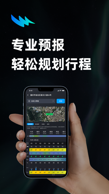
Screenshot of Xinzhi Satellite Cloud Image

Software functions


​​​Data is measured in half an hour and updated 24 hours a day.

Get weather information by city name, support voice search

Get real-time data from the Central Meteorological Observatory and obtain current and previous cloud images over China and surrounding areas.

​ ​ ​Auto-play function to dynamically watch the development of clouds.

You can choose the picture quality and the number of pictures to view, which saves traffic.

It can be viewed by time period, and the cloud image can be saved in the photo album function.
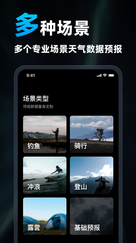
Screenshot of Xinzhi Satellite Cloud Image

FAQ


Not skilled in function operation

Problem description: Users are not familiar with certain functions in the APP, such as how to switch cloud image types, how to view rainfall forecasts, etc.

Solution: Read the APP instructions or help documents carefully to understand the specific operation methods of each function. At the same time, there are usually operation guides or video tutorials in the APP, and users can quickly master the usage through these resources.

Missing or abnormal functions

Problem description: Users find that some expected functions are missing from the APP, or some functions cannot be used normally.

Solution: First check whether the APP is the latest version, because the new version may fix bugs in the old version and add new features. If the problem persists, you can contact the APP’s customer service team to report the problem and seek a solution.

New knowledge satellite cloud image update log:


1.Fix some bugs

2. Optimized some functions

Huajun editor recommends:

Say goodbye to junk software, Xinzhi Satellite Cloud Atlas is a green and safe software, the editor has personally tested it! Our Huajun Software Park serves you wholeheartedly. There are alsoAotu Car Rental,Google Earth 2021,OnStar,Xingruan Auto Link,360 search map, available for you to download!

FAQ