


 You may like


Highlights of Wandering Earth 3D Satellite Map
Real-time data update: The software continuously updates data to ensure that users can obtain the latest map information and attraction details.
Multiple measurement tools: Provides a variety of measurement tools, such as distance measurement, area measurement, etc., to facilitate users to accurately measure geographic information.
Offline use: Supports offline download function, users can use the map without network environment and view the required information anytime and anywhere.

Features of Wandering Earth 3D Satellite Map
Global attraction query: Users can pay attention to the global map vision and quickly find and learn about well-known attractions around the world through classic search and flexible sliding operations.
Precise address search: Flexibly search for addresses on your mobile phone, the search results are accurate and reliable, and provide users with free navigation services at any time.

Wandering Earth 3D satellite map function
Domestic street view display: It contains rich domestic street view visuals. Users can watch various beautiful street views through satellite maps.
Panoramic mode experience: Provides panoramic mode to push street views in a three-dimensional way, allowing users to flexibly view various modes on their mobile phones and enjoy an immersive map experience.
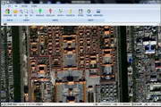
Three-dimensional map: Shows the quick-resolution effects of different maps, provides exquisite 3D vision and three-dimensional map background, allowing users to have a more intuitive understanding of geographical information.

Wandering Earth 3D Satellite Map FAQ
Question: What operating systems does Wandering Earth 3D Satellite Map mobile version support?
Answer: The mobile version of Wandering Earth 3D Satellite Map usually supports the two mainstream operating systems of Android and iOS. Users can search and download the app in their respective app stores.
Question: How to update the data of Wandering Earth 3D satellite map?
Answer: The Wandering Earth 3D satellite map will be updated regularly to ensure that users get the latest map information and attraction details. Users do not need to update manually, just maintain the network connection, and the application will automatically download and update data in the background.
Question: Does Wandering Earth 3D satellite map support offline use?
Answer: Yes, Wandering Earth 3D satellite map supports offline download function. Users can select the map area that needs to be downloaded and download it offline when there is an Internet connection. After the download is completed, users can use the map function normally even in an environment without network.
Question: How do I search for and view a live map of a specific location?
Answer: After opening the Wandering Earth 3D Satellite Map application, users can enter the address or attraction name they want to query in the search box. The app will quickly locate the location and display a map of it. Users can also view maps from different angles and ranges by sliding the screen.
Wandering Earth 3D satellite map update log:
1. Fixed several bugs;
2. Optimize details;
Huajun editor recommends:
Wandering Earth 3D Satellite Map is a software that is completely fool-proof and super simple to operate. In addition, the editor also recommends it.Aotu Car Rental,Google Earth 2021,OnStar,Xingruan Auto Link,360 search mapDownload and use related software.


Your comment needs to be reviewed before it can be displayed