Land Survey CloudSoftware introduction
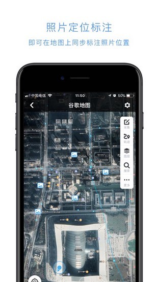
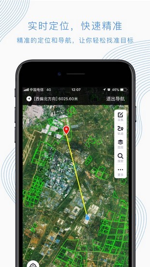
The land survey cloud app software is a mobile application software that serves land survey and natural resource management. The land survey cloud app has real-time query service functions for land survey, basic farmland, land planning, remote sensing images and natural resource protection areas, especially auxiliary field survey business functions such as "shooting at will", which can effectively improve the work efficiency of field surveys, help improve the informatization level of natural resource management, and facilitate staff to carry out their work scientifically and efficiently.

Land Survey CloudSoftware function
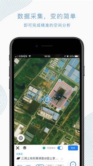
1. Inquiry method:
Standing point query: Standing point within 200 meters;
Range query: Any range query within 1,000 acres
2.Send request:
Waiting for background cloud computing, results will be returned in about 15 seconds
3. Determine the scope:
Click to undo the adjustment range or clear and redraw

Land Survey CloudSoftware features
1. Friendly interface and convenient operation,
2. Mainly provides auxiliary field functions such as "cloud query" and "snapshot"
3. Can effectively assist field surveys, inspections, and daily local management work

Land Survey CloudFAQ
What is "Land Survey Cloud"?
"Land Survey Cloud" will play an important role in the "Three Adjustments"
“Using the most advanced scientific and technological means to complete the third national land survey.” With the launch of the third national land survey, the great era of “Land Survey Cloud” has arrived.
What kind of power and effectiveness will the "Land Survey Cloud" play in the three adjustment work?
What should we do when the country discovers, through satellite remote sensing monitoring, that a large number of land parcels distributed in more than 2,800 counties across the country have undergone questionable changes, but there are not enough technical personnel to go to the site to personally inspect these parcels? The "Land Survey Cloud" can quickly send these questionable maps to the land investigators of the land and resources offices in various places. The investigators quickly find these parcels through Amap Navigation, take field photos with their mobile phones, and transmit these photos to Beijing in real time through the "Land Survey Cloud".
What should we do when the state finds, through comparison of satellite images, that there are doubts about the land survey data reported by the local government due to various reasons but cannot send personnel to verify it on the spot in real time? Through the "Land Survey Cloud", staff can direct investigators to the scene online, take photos or videos with their mobile phones at designated stations and directions, and watch the scene in real time on the screen, effectively preventing local governments from falsely reporting and concealing land survey data.
It is reported that the core of the construction of "Land Survey Cloud" is the integrated innovation of four key technologies, including big data processing, cloud architecture system, artificial intelligence support and security and confidentiality technology. By conducting research on key big data processing technologies, the China Land Survey and Planning Institute has initially achieved integrated storage and batch intelligent processing of massive land data. Facing the "Three Adjustments", the China Land Survey and Planning Institute will further optimize the performance of the "Internet + Evidence Cloud" in the next step to meet the high concurrent needs of massive users brought by nearly 100,000 land investigators and about 50 million evidence plots in the "Three Adjustments"; at the same time, in order to solve the problem of inconsistent mastery standards for local investigators and nowhere to answer difficult survey questions, the "Intelligent Survey Cloud" will be launched to provide cloud query of land samples and expert online support to realize the primary intelligent survey service of "computer + human brain".
“Land Survey Cloud” has unlimited application prospects
Most of the land data is classified data. How to solve the security and confidentiality issues when putting the data on the cloud?
It is reported that during the construction process of the "Land Survey Cloud", the China Land Survey and Planning Institute conducted a special study on this and proposed a professional solution - the establishment of three major network security systems.
The basis of this system is comprehensive data processing. First, dynamic tile technology is used to process vectors and images to reduce data accuracy; second, the outgoing data is photographed and coordinate information is removed; third, the National Bureau of Surveying, Mapping and Geographic Information's online "Tian Map" is directly used to provide location services. The core is physical isolation switching. Query requests come in through a one-way gate, and the query results are in the form of photos and go out through the physically isolated image identification single gate and the optical disc ferry. The support is cloud security protection. Internet-oriented cloud applications must be supported by firewall protection, attack prevention, and filtering of pornographic and political content. Through these three major measures, the problem of data confidentiality has been effectively solved.
In addition, according to the application requirements of the "Land Survey Cloud", the China Land Survey and Planning Institute has established a hybrid cloud management architecture that takes into account the advantages of public cloud and private cloud, and established an enterprise dedicated line to achieve a safe, fast and reliable data channel.
Gao Yanli, President of the China Institute of Land Survey and Planning, said that the construction of the "Land Survey Cloud" is a huge systematic project that must be demand-oriented, guided by the framework system, driven by proactive innovation, and based on teamwork, and provide application services such as "Internet + Evidence Cloud", "Intelligent Survey Cloud" and "Emergency Monitoring Cloud" to solve the most realistic and urgent problems in land survey at present, and create products and services that users can feel as soon as possible.
It is reported that the "Internet + Evidence Cloud" work has been deployed across the country recently, and more than 2,800 county-level investigators will provide online evidence for about 1 million monitoring patterns in 2017.
The application prospects of “Land Survey Cloud” are limitless. Gao Yanli said that in the near future, a publicly available social version of land management and land survey data services will be provided to mobile phone users in need, and faster and more accurate change data will be collected from thousands of public mobile phones to update the land survey database in a timely manner. In the future, no matter where there are incidents that damage cultivated land and damage the ecology, through the "Land Survey Cloud", they can be discovered in time, take timely measures, and effectively stop them.
Land Survey Cloud Update Log
1. The pace of optimization never stops!
2. More little surprises are waiting for you to discover~
Huajun editor recommends:
The land survey cloud has the same complete functions as the official product, the interface is more beautiful and elegant, and the design is more complete. It continuously meets the needs of users. Welcome to download. Those who are interested can also downloadJianxin Rongtong,Universal charger,Orange Heart Digital,spring manual,calculator


 You may like


Useful
Useful
Useful