Field Elf Highlights
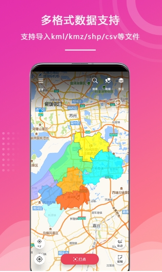
Precise location positioning
It adopts GPS+ network mode and combines multi-constellation positioning, base station assistance and AGPS technology to achieve fast and accurate position determination.
Simple map drawing
Supports rapid drawing and attribute editing of point, line, and area features, making it convenient for users to collect required information anytime and anywhere.
Simple track record
Click to start recording the trajectory and count trajectory information in real time, such as distance, speed, etc.
Field Elf Features
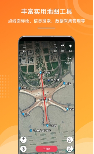
Strong project engineering management
It supports the creation of a project for each collection, and the elements within the project are classified and managed in folders to facilitate data organization and search.
Custom collection properties
Users can customize collection attributes according to actual needs to adapt to various field scenarios.
Wireless offline map
Supports Mapsforge vector maps, offline map package downloads, etc., ensuring free and convenient plotting even in a non-network environment.
Field Wizard function
Multiple file export formats
Provides a variety of data file export formats to meet users' different export needs.
Multiple export properties
When exporting files, you can check options such as export associated attachments, export and share, etc. to increase the flexibility of data use.
Rich engineering data classification
Different classification methods such as points, lines, surfaces and trajectories are provided to facilitate users to classify and manage data.
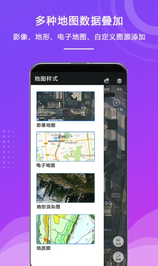
Diverse online maps
It has a variety of map options such as comprehensive maps, road maps, satellite maps, and terrain maps to meet users' different viewing needs.
Two state maps
It supports both online and offline map viewing, ensuring that users can use it normally in any environment.
real-time statistics
After turning on the track recording function, the user's track information can be recorded and counted in real time, making it easier for users to understand their itinerary.
Field Elf FAQ
Question: Does the Field Wizard app support offline use?
Answer: Yes, the Field Wizard app supports offline use. Users can download offline map packages and perform normal plotting and data collection even in a non-network environment.
Question: How to customize collection attributes?
Answer: In the Field Wizard app, users can customize collection attributes according to actual needs. Enter the collection settings or project management interface, select the custom collection attribute option, and then follow the prompts to set it.
Question: What file export formats does Field Wizard app support?
Answer: The Field Wizard app supports a variety of file export formats, such as KML, GPX, Shapefile, etc., to meet the different export needs of users.
Field Elf update log:
1. Optimize content
2. The details are more outstanding and bugs are gone.
Huajun editor recommends:
Field Wizard, word-of-mouth software, is guaranteed to solve all your problems! The editor highly recommends! There are similar software on this siteGoogle Earth 2021,Tantu offline map,OnStar,Xingruan Auto Link,360 search map, if you are interested, you can download it!


 You may like






Your comment needs to be reviewed before it can be displayed