
-
surveyor
- Size: 129.7M
- Language: Simplified Chinese
- Category: Utility tools
- System: android
- Manufacturer:Henan Ice Measurement Technology Co., Ltd.


Surveyor Official Version is a measurement tool that can be used on smartphones. The surveyor has the characteristics of accurate calculation, easy and efficient, intelligent and convenient, and adopts the feedback and suggestions of the majority of surveyors to make the operation more humane. The surveyor also has common functions for setting out road, bridge and tunnel construction, such as forward and reverse calculation of mileage coordinates, tunnel over and under excavation, slope setting out, and structure setting out. Huajun Software Park provides download services for surveyor software. To download other versions of surveyor software, please go to Huajun Software Park!

Surveyor software features
1. Accurate:
After 3 years and hundreds of versions of optimization, the algorithm is mature, supports intersection method, line element method, and is applicable to all common line shapes in engineering. 6 series expansions and multiple integration methods allow you to control calculations at the slightest detail.
2. Easy:
Quickly switch between multiple lines, copy and paste within the program, intelligent error correction, retain the original results when switching pages, personalize the layout, and display the results of multiple calculations, allowing you to easily cope with daily calculations and stakeout.
3. Efficient:
Supports connecting total station and RTK via Bluetooth or Bluetooth adapter to receive and calculate measurement results in real time. Save time on manually inputting coordinates, free your hands, save time and efficiency, and save costs.
4. Powerful:
Graphically displayed cross-section views and calculation results are clear at a glance. The section library supports importing CAD section drawings, making section editing no longer cumbersome. Support tunnel cross-section scanning and export of CAD drawings, replacing the cross-section instrument, which is smarter and easier to use.

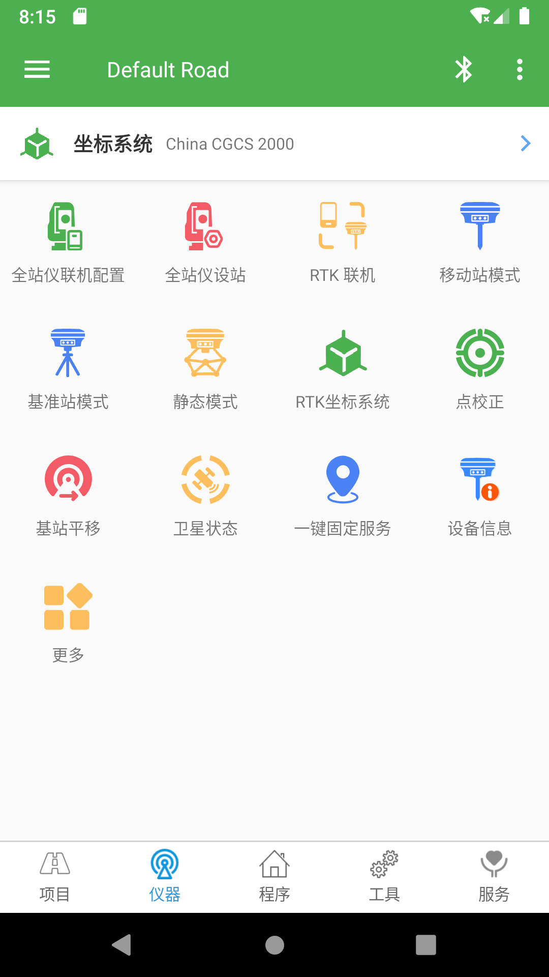
Surveyor Software Features
1. Multiple lines can be established, independent of each other, and switched quickly;
2. Supports broken links, including long chains and short chains;
3. Supports two flat curve input methods: intersection method and line element method, and supports various linear lines;
4. Vertical curves not only support slope points, but also polyline points, making them more applicable;
5. Tunnel sections and slope sections support direct import of CAD section drawings, eliminating the complexity and trouble of editing sections;
6. Support online total station measurement, which is efficient, time-saving and easy. Currently supported instruments are: Leica, Topcon, Southern, Sokkia, Sanding, Suyiguang, Pentax, Midlatitude, Kolida, Nikon, Covey, Bowfield, Red, and Hi-Tech;
7. Supports calculating coordinates at any mileage, any offset, and any included angle;
8. The coordinates are inversely calculated to support the calculation of multiple solutions in complex lines. There is no need to enter nearby mileage, and the algorithm is complete;
9. Supports graphical staking, which is more intuitive and easier to check for errors.
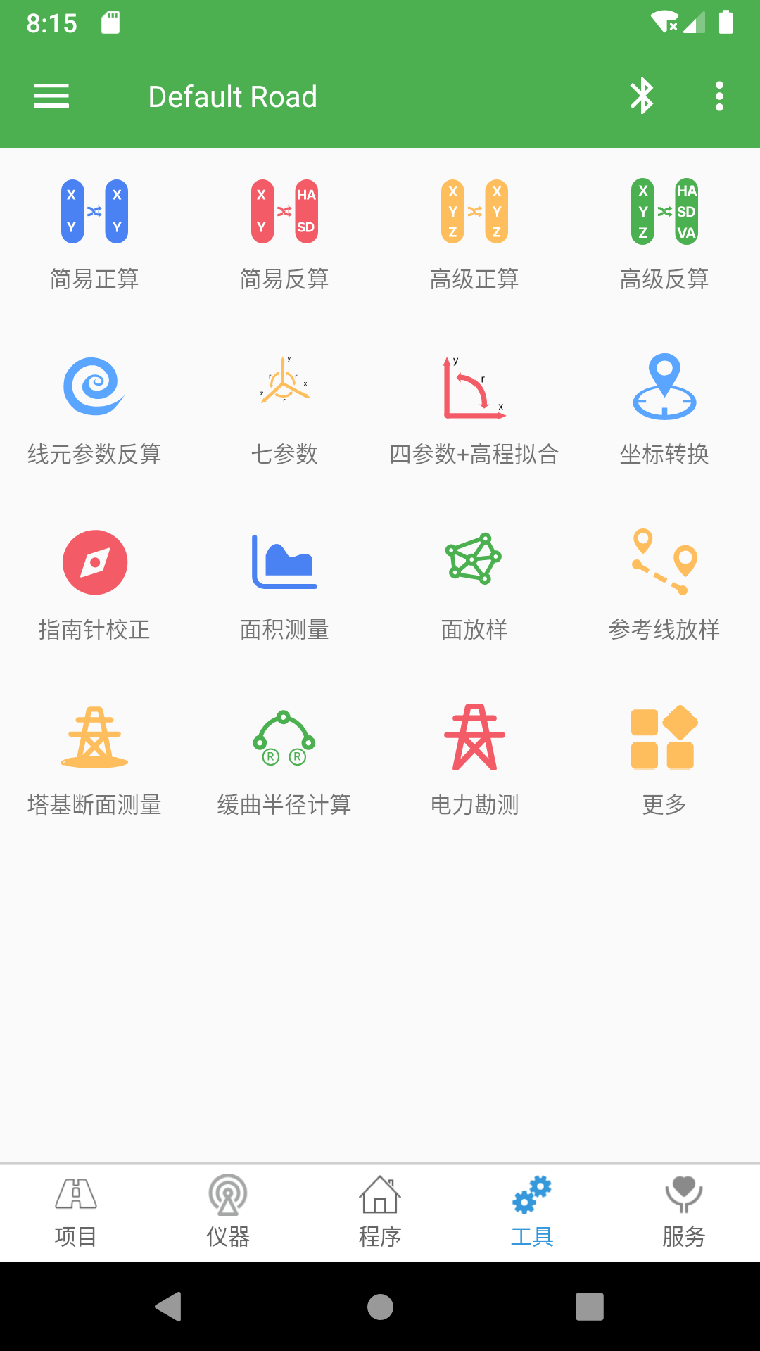
10. Support batch calculation and export to Excel and TXT;
11. Supports recording function, and can export stakeout records to Excel and TXT;
12. Support tunnel cross-section scanning to export CAD drawings, replacing the cross-section scanner, setting up a station at any point, no need for computer post-processing, and the mobile phone can directly produce CAD drawings.

How to use surveyors
We first open the software and then click on the instrument
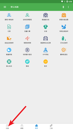
Select a measurement instrument, such as positioning, and click OK.
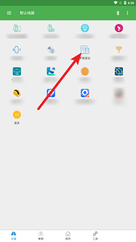
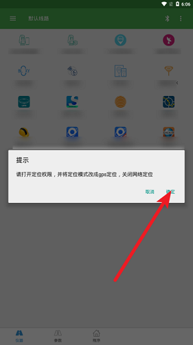
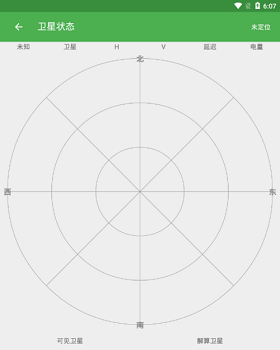
Click the switch in the upper right corner, then you can know the current positioning at this time.

To calculate, click Tools and select an equation.
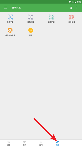

Input parameters such as coordinate axes and click Calculate to get the measured and calculated values.


Comparison of similar software
Measurement Calculation ToolboxThe official version is a lightweight, convenient and practical calculation tool. The latest version of the Measurement Calculation Toolbox is a practical calculation software developed by netizens. The official version of the Measurement Calculation Toolbox has functions such as equal level approximate adjustment, graph root traverse 1:500 approximate adjustment, geodetic coordinates to space rectangular coordinates, forward and inverse geodetic coordinate calculations, angular intersection fixed point calculation, etc.
Ocean survey softwareIt is a multi-function software provided by Hi-Target that can realize ocean survey. The green version of the ocean survey software can be equipped with a variety of imported and domestic GPS receivers, and can control a variety of domestic and foreign depth sounders online in real time. It has a task-oriented working mode, a fool-like operation interface, and integrates multiple functions of measurement and editing.
FAQ
GPS/total station connection failed
Confirm that the device's Bluetooth or data cable connection is normal.
Check the port settings (such as baud rate and COM number must be consistent with the instrument).
Restart the device and software and pair again.
Coordinate calculation error is large
Check parameter settings (such as projection parameters, central meridian).
Check whether the original data contains gross errors (such as misentering the prism height).
Calibrate instruments (such as adding constants and multiplying constants for total stations).
Surveyor update log
1.Add WeChat login
2. Added file manager support for calling WeChat and QQ files
3. Optimize the speed of satellite map navigation import and loading CAD
4. Optimize the Android 11 system CAD drawing viewing, CAD lofting when opening drawings, open the system's built-in file manager to browse files
5. Optimize the five-unit intersection method to support the situation where the starting and ending transition curves are incomplete
6. Modify the tunnel feature point calculation to cancel reading the lifting parameters, change to default reading, and add the display of the section lifting amount
7. Add a clear option in the upper right corner of the reserved and buried parameters for the repair tunnel
8.Fix the arc calculation bug in reference line lofting
9. Repair the problem of incorrect judgment of mileage overlap in slope section mileage matching.
10.Fixed the problem of update failure after modifying some elements of line element method flat curve parameters
11.Fixed the problem of individual RTK connection progress bar crashing
12.Fixed the abnormal voice broadcast of some mobile phones
Huajun editor recommends:
The surveyor has the characteristics of accurate calculation, easy and efficient, intelligent and convenient, and adopts the feedback and suggestions of the majority of surveyors to make the operation more humane. Even someone like me who is new to using it can quickly master it, which is a big thumbs up! Recommended for everyone to download!
Version: 15.9.24.19.28 | Update time: 2025-09-26
Similar recommendations


Latest updates

How to check for updates in Movie Paradise? -How to check for updates in Movie Paradise
How do I view my collection in Movie Paradise? -How to view collections in Movie Paradise
How to cancel the account in Movie Paradise? -How to cancel your account at Movie Paradise
How to back up the Flash Wizard - How to back up the Flash Wizard
How to clear the cache of Movie Paradise? -How to clear the cache of Movie Paradise
How to check the privacy policy of Movie Paradise? -How to view the privacy policy of Movie Paradise
How to give feedback on Movie Paradise? -How to give feedback to Movie Paradise
surveyor comments
-
1st floor Huajun netizen 2022-03-29 07:39:18After downloading Surveyor, you can also use it on Android tablets, which is very good!
-
2nd floor Huajun netizen 2022-03-15 18:33:22Recently, many people have recommended surveyors, and I have had a good experience with them.
-
3rd floor Huajun netizen 2022-02-20 22:01:27The surveyor downloaded here can be used by my friends and I on different Android phones, and it’s a great review!
Recommended products


- Diablo game tool collection
- Group purchasing software collection area
- p2p seed search artifact download-P2P seed search artifact special topic
- adobe software encyclopedia - adobe full range of software downloads - adobe software downloads
- Safe Internet Encyclopedia
- Browser PC version download-browser download collection
- Diablo 3 game collection
- Anxin Quote Software
- Which Key Wizard software is better? Key Wizard software collection