-
Google Earth
- Size: 73.1M
- Language: English
- Category: Astronomy and geography
- System: Winxp/vista/win7/2000/2003


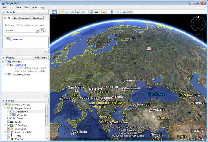
Google EarthThe official version is fromGoogleA virtual globe launched for users. The official version of Google Earth uses3D mapPositioning technology can turn Google Take Map to the next level with the latest satellite imagery. andGoogle EarthSatellite photos, aerial photography and GIS can also be arranged on a three-dimensional model of the earth. Users canGoogle EarthBrowse other areas for live street scenes and local nature. Huajun Software Park provides you with free download of Google Earth2024. Friends who like Google Earth, come to Huajun Software Park to download and experience it!

Google Earth software features
*Street View: Street View highlights, including the Taj Mahal and the Grand Canyon and many more unforgettable Street View images
*Aerial view: Beautiful scenery around the world seen from space, you can have an unobstructed view of the islands around Cuba
*3D City: Realistic 3D city and town display windows, combined with existing VR technology, with realistic scenes
*Satellite imagery: a large number of aerial images
*Essence Tour: Thousands of Voyaer locations to choose from. Quickly browsing a few of them will give you an immersive feeling
Google Earth software features
1. Google Earth is a virtual globe software developed by Google. It combines satellite images, maps, encyclopedias and flight simulators and places them on a three-dimensional model of the earth.
2. Google Earth can take you to any location, where you can view satellite images, maps, various terrains and 3D buildings, including the Milky Way in outer space and ocean canyons.
3. You can add landmarks, routes, travel routes, images, etc.
Google Earth installation steps
1. Download Google Earth from the Huajun Software Park and get a software compressed package.

2. Then we unzip the software package and get the GoogleEarthProPortable.exe application.
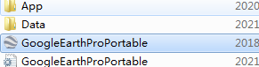
3. Double-click to open the GoogleEarthProPortable.exe application and you can use it.
How to use Google Earth
How to draw a grid?
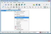
1. First, we click the "Add Polygon" button in the toolbar above Google Earth.
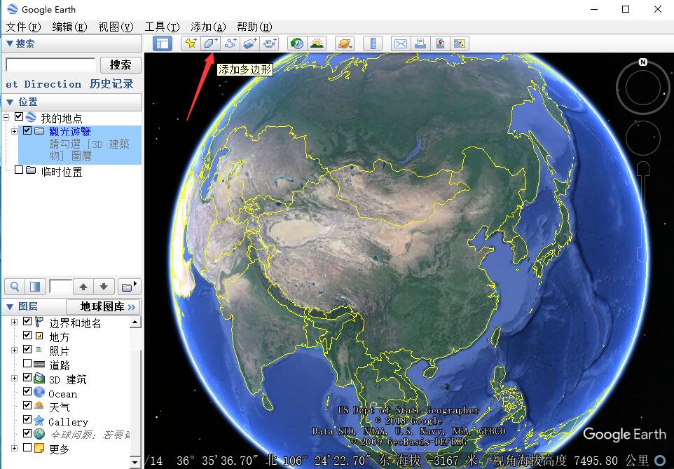
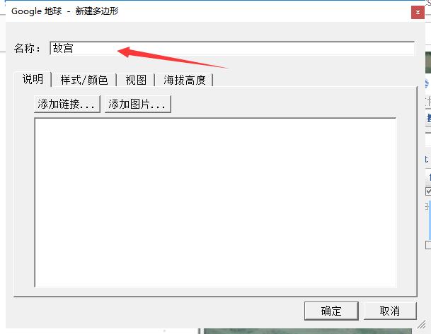
2. Then in the newly opened "New Polygon" window, name the polygon that needs to be drawn. For example, we change it to "Forbidden City".
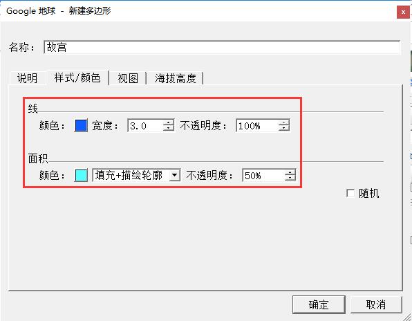
3. Then under the "Style, Color" tab, select the edge color, width and transparency of the polygon, and then select the fill color and transparency in the polygon.
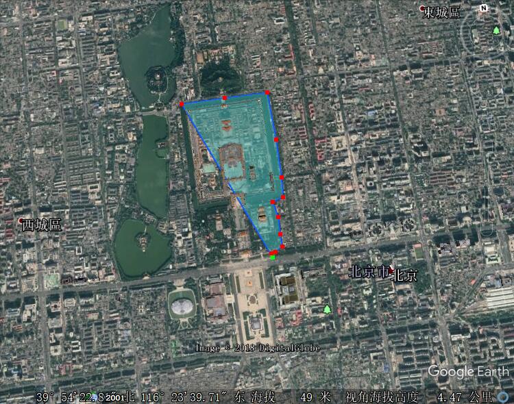
4. Then, while keeping the "New Polygon" window open, select the required polygon frame on the map.
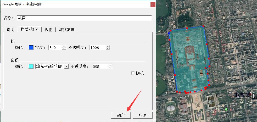
5. When the area selection is completed, click the "OK" button.
Google Earth FAQ
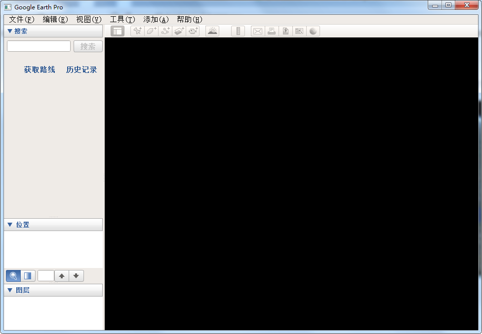
Question: Recently, the screen turned into a black screen after opening Google Earth?
Answer: Open the C:WINDOWS/system32/driversetc folder, then open the hosts inside, open the file with Notepad, then open it and add a line at the end

After adding it, save it and restart it and the problem will disappear.
Question: How to search on Google Earth?
Answer: First we need to know the coordinates of the location we want to search for. For example, if we want to search for the Arc de Triomphe, we can directly enter the coordinates of the Arc de Triomphe, 48°52'26.79"N, 2°17'42.66"E, into the input box on the upper left of Google Earth, and then click the "Search" button at the back to find the Arc de Triomphe.
Comparison of similar software
" "AR globe" is an interactive product created by Huanzhi Education to help stimulate children's understanding of the world. The content covers rich and comprehensive knowledge such as geography, humanities, biology, astronomy, meteorology, etc. "AR Globe" breaks the traditional globe. It is no longer just a globe that can only see the map, but also adds vivid and realistic three-dimensional models and introductions to each major section. Multimedia such as audio and three-dimensional animation are displayed on mobile phones and tablet devices, upgrading the traditional graphic cognitive education model, stimulating children's interest and bringing a different experience of exploring the world.
GlobeIt is a software that displays a globe. Globe The globe software is very powerful and contains information on more than 10,000 cities. You can find the city data you need anytime and anywhere. Not only that, we can also use Globe Globe to experience overlooking the entire earth.
Google Earth update log:
1. Modify user-submitted bugs
2.Add new features
Huajun editor recommends:
Google Earth can help you solve many problems. I believe that as long as you dare to use it, you will definitely fall in love with it. We also recommend you the Shanghai World Expo online game, hydrological frequency intelligent analysis system, and Yizibo.
Version: 7.3.4.8428 Official version | Update time: 2024-12-31
Similar recommendations


Latest updates


How Google Earth displays the movement of sunlight on the ground
The operation process of drawing a circle with a radius of 500 meters from a point on Google Earth
Graphic tutorial for downloading clear satellite images from Google Earth
How to switch to map view from Google Earth
Steps to set language for Google Earth
115 How to enable the boss button in the browser? -115How to enable the boss button in the browser
115How to change the network name in the browser? -115 Methods to modify network name in browser
How to import audio in scratch-How to import audio in scratch
How to add characters to scratch-How to add characters to scratch
Google Earth review
-
1st floor Huajun netizen 2022-03-29 01:52:32Google Earth is very useful, thank you! !
-
2nd floor Huajun netizen 2021-08-12 11:06:42Google Earth software is very easy to use, downloads quickly and is very convenient!
-
3rd floor Huajun netizen 2021-10-04 15:59:00Google Earth is awesome! 100 million likes! ! !
Recommended products


- Diablo game tool collection
- Group purchasing software collection area
- p2p seed search artifact download-P2P seed search artifact special topic
- adobe software encyclopedia - adobe full range of software downloads - adobe software downloads
- Safe Internet Encyclopedia
- Browser PC version download-browser download collection
- Diablo 3 game collection
- Anxin Quote Software
- Which Key Wizard software is better? Key Wizard software collection