-
Google Earth Pro
- Size: 121.85M
- Language: Simplified Chinese
- Category: Astronomy and geography
- System: Winall


Google Earth Pro is a software that uses 3D map positioning technology to push the latest satellite images on Google Map to a new level. Users can search for a specific area on the 3D map, zoom in and out of the virtual image, and then form a driving guide. In addition, Google Earth Pro has also carefully crafted a special option - a bird's-eye view of the journey, which makes motorists more energetic. Google Earth mainly achieves these above-mentioned functions by accessing Keyhole's extended database of aerospace and satellite images. The database was updated last week. It contains a large amount of terrain data provided by NASA, and will cover more terrain in the future, including pastoral areas, wastelands, etc. Friends who like Google Earth Pro, come to Huajun Software Park to download and experience it!

Google Earth Pro features
High-definition satellite imagery and 3D modeling
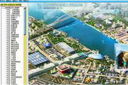
Google Earth Pro provides high-resolution satellite images around the world, allowing users to clearly see detailed details on the ground, including buildings, roads, natural landscapes, etc.
Some cities and regions support detailed 3D architectural models, and users can "fly" into the interior of the building to experience immersive exploration.
Historical images and timeline
Supports viewing satellite images of different years. Users can use the timeline function to compare changes in the same area at different points in time, such as urban expansion, the impact of natural disasters, etc.
This feature is of great value in areas such as geographical research, environmental monitoring and urban planning.
Advanced measurement tools
Providing land area, radius and perimeter measurement functions, users can measure directly on the map and obtain accurate data.
Supports printing high-resolution screenshots to facilitate users to save and share exploration results.
Geographical data import and export
Supports the import of geographical data files in KML, KMZ and other formats, and users can integrate external data into Google Earth Pro for analysis and visualization.
The export function allows users to save map data into image or video formats for easy use in other platforms or software.
Multi-view mode and layer management
Provides multiple view modes such as ordinary maps, satellite images, topographic maps, etc., and users can switch to view as needed.
In the left layer panel, users can check options such as "Border", "Road", and "3D Building" to enhance the display of map information and meet the needs of different scenarios.
Google Earth Pro Features
Geographic Research and Education
Geographers can use Google Earth Pro's high-definition imaging and historical imaging functions to study geographical phenomena such as surface changes and urban expansion.
Educational institutions can use it as a teaching tool to help students intuitively understand geographical knowledge and improve their interest in learning.
Urban Planning and Environmental Protection
Urban planners can use Google Earth Pro's 3D modeling and measurement tools to carry out urban design, building layout and transportation planning.
Environmental organizations can use its historical imaging function to monitor environmental changes such as deforestation and ice cap melting, and provide data support for environmental protection.
Business Analysis and Market Research
Enterprises can use Google Earth Pro's geographical data import function to analyze competitor location, asset management, risk assessment and other information.
The traffic data/flow information function can help companies improve operations and improve logistics efficiency.
Outdoor adventure and travel planning
Outdoor enthusiasts can use Google Earth Pro's street view mode and 3D terrain function to plan adventure routes in advance and understand the topography of the destination.
Travelers can use its virtual travel function to browse destination street views and 3D architectural models in advance and make detailed travel plans.

Google Earth Pro Highlights
Multi-platform support
Google Earth Pro provides desktop versions (Windows, macOS, Linux) and mobile versions (Android, iOS), and users can seamlessly switch between different devices.
The web version does not require installation and runs directly in the browser, supporting mainstream browsers such as Chrome, Firefox, Opera and Edge.
Data integration and updating
Integrate multiple satellite image companies (such as DigitalGlobe, GeoEye) and aerial photography data to ensure image quality.
Satellite images and 3D model data are regularly updated to maintain the timeliness and accuracy of the software.
user friendliness
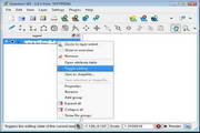
The interface is simple and intuitive, and the operation is convenient. Users can freely explore the earth with simple operations such as zooming in and out with the mouse wheel, holding down the left mouse button and dragging the map to pan.
Provides rich help documents and tutorial videos to help users quickly get started and master advanced functions.
Google Earth Pro FAQ
Layers are not displayed or are not fully displayed
Possible reasons: The layer is not enabled, the opacity is set too low, the zoom level does not match, the geographic coverage is outside, the layer is deprecated or needs to be upgraded.
Solution:
Check that Show Features is selected next to the layer in the left panel.
Adjust the layer's opacity slider.
Try zooming in or out to match the zoom level.
Verify that the current view is within the layer's data coverage.
If it is an advanced layer, confirm that the Professional or Professional Premium plan is valid.
Google Earth Pro update log:
1. Fixed several bugs;
2. Optimize details;
Huajun editor recommends:
Google Earth Pro has always been the most commonly used software by most netizens. Huajun Software Park also has Easy Copybook, .NET, Batch Butler, etc. which are also very popular software among netizens. You can download them from Huajun Software Park!
Version: 7.3.6.10201 | Update time: 2025-12-02
Similar recommendations


Latest updates


Google Earth Pro Review
-
1st floor Huajun netizen 2019-04-09 14:20:27Google Earth Pro is very useful, thank you! !
-
2nd floor Huajun netizen 2019-08-21 18:11:00The interface design of Google Earth Pro is very easy to use and has rich functions. I highly recommend it!
-
3rd floor Huajun netizen 2020-10-25 03:04:34Google Earth Pro has quite comprehensive functions. It is the latest version and is free to download. Keep up the good work!
Recommended products


- Diablo game tool collection
- Group purchasing software collection area
- p2p seed search artifact download-P2P seed search artifact special topic
- adobe software encyclopedia - adobe full range of software downloads - adobe software downloads
- Safe Internet Encyclopedia
- Browser PC version download-browser download collection
- Diablo 3 game collection
- Anxin Quote Software
- Which Key Wizard software is better? Key Wizard software collection