-
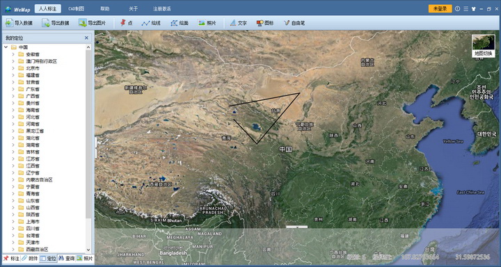
Miniature offline Google satellite map CAD labeling and plotting system
- Size: 43.93M
- Language: Simplified Chinese
- category: Text editing
- System: Winxp/vista/win7/win8/2000/2003
Version: 2.0 build534 | Update time: 2016-09-08
Similar recommendations
Latest updates
How to change the interface language in Xshell - How to change the interface language in Xshell
How to set encoding in Xshell-How to set encoding in Xshell
How to clear browsing data in QQ Browser? -QQ Browser clears browsing data
How to set QQ Browser as the default browser? How to set QQ browser as default
How to draw arrows in coreldraw? -Coreldraw method of drawing arrows
Review of Micro Offline Google Satellite Map CAD Annotation and Plotting System
-
1st floor Huajun netizen 2021-01-02 04:20:26The interface design of the miniature offline Google Satellite Map CAD annotation and plotting system is very easy to use and has rich functions. I highly recommend it!
-
2nd floor Huajun netizen 2021-04-30 18:10:17The miniature offline Google satellite map CAD annotation and plotting system software is very easy to use, the download speed is very fast, and it is very convenient!
-
3rd floor Huajun netizen 2019-06-18 03:16:35I hope the miniature offline Google satellite map CAD annotation and plotting system will get better and better, come on!
Recommended products
- Diablo game tool collection
- Group purchasing software collection area
- p2p seed search artifact download-P2P seed search artifact special topic
- adobe software encyclopedia - adobe full range of software downloads - adobe software downloads
- Safe Internet Encyclopedia
- Browser PC version download-browser download collection
- Diablo 3 game collection
- Anxin Quote Software
- Which Key Wizard software is better? Key Wizard software collection


