-
Google Earth XP Special Edition
- Size: 118.36M
- Language: Simplified Chinese
- Category: System assistance
- System: winXP and above


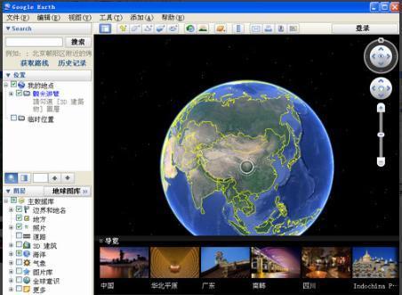
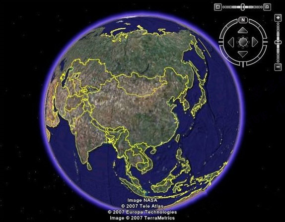
Google Earth XP Special Edition official version is a powerful satellite map software developed by Google. Google Earth XP Special Edition is built using advanced 3D map positioning technology and has a large amount of terrain data. Users can browse the topography of various countries. The latest version of Google Earth is suitable for winXP systems and supports services such as local search and driving guides. Users can learn about the world without leaving home.

Google Earth XP Special Edition software features
1. Can measure length and height
2. Rare animal tracking system
3. Real-time weather monitoring function
4. Street view function
5. Combined with satellite images, maps, and powerful Google search technology; global geographic information is right before your eyes.
6. From a space odyssey to a glimpse of our neighbors
7. Enter the destination and zoom in directly
8. Can search for schools, parks, restaurants, hotels
9. Get driving guide
10. Provide 3D terrain and buildings, and the viewing angle supports tilting or rotating
11. Save and share searches and favorites
12. Add your own comments
13. You can fly your own aircraft (F-16 and SR-22).
14. You can also view maps of Mars, the moon and the starry sky.
15. Can measure length and height
16. Rare animal tracking system
17. Real-time weather monitoring function
18. Street view function
19. Earth city night view function
20. You can use Panoramio to pin your photos to Google Earth
21. If you have software, you can make your own 3D buildings and upload them
Advantages of Google Earth XP Special Edition Software
1. Compatible with GPS (Global Positioning System)
Google Earth is newly compatible with the Global Positioning System and can find specific locations more accurately.
2. High-quality printing
Google Earth has clearer and more accurate print quality.
3. Email customer service
It is convenient for users to provide feedback, and customer service to provide help and suggestions.
4. Richer annotations
It enriches the location data in Google Earth and provides richer and more accurate annotations to facilitate user query and understanding.
5. Data import
Introducing new data enriches Google Earth’s existing powerful database and updates it more comprehensively.
6. Provide 3D terrain and buildings
A major breakthrough in the new version of Google Earth is that it provides 3D terrain and buildings, and the viewing angle also supports tilting or rotation, allowing users to understand specific information more intuitively and clearly.
7. Save and share searches and favorites
Isn’t this a very considerate feature? Google Earth has added the ability to save and share searches and favorites, so you no longer have to worry about losing them!
8. Add your own comments
It is also a very innovative and caring new feature. Users can add their own comments while using Google Earth, enriching the software data and leaving their own mark at the same time!

Features of Google Earth XP Special Edition software
street view
Street View is a new service launched by Google Earth, which can achieve the effect of tourism and is shot by a specialized shooting vehicle. Countries and regions with Street View in Google Earth are:
Asia: Hong Kong, Macau, Taiwan, Singapore, Japan, South Korea (Seoul, Busan), Thailand (Phuket, Chiang Mai, Bangkok), Iraq (National Museum of Iraq, Baghdad), Israel (Haifa, Tel Aviv, Jerusalem area), India (National Museum of India, New Delhi, National Museum of Fine Arts).
Europe: Norway, Sweden, Finland, Denmark, the United Kingdom, Ireland, France, Spain, Portugal (Lisbon, Porto), the Netherlands, Belgium, Germany (part), Switzerland (part), Romania (part), Italy, Russia (Moscow, Kazan, St. Petersburg), Poland (part), Ukraine (Kiev, Odessa, Lviv, Kharkiv, Donetsk), Czech Republic (part), Greece (Acropolis Museum), Austria (Kunsthistorisches Museum, Vienna).
Africa: South Africa, Canary Islands (West).
Oceania: Australia, New Zealand.
North America: United States (including Alaska, Hawaii), Canada (part), Mexico.
South America: Brazil (part).
Antarctica: An island near the southern part of Greenwich Island in Antarctica.
city night view
Just click on “Photo Gallery” in the sidebar, and then click “NASA”. There is a “Earth City Night Scene” function. Open it and click the “Earth City Night Scene” button to watch the global night lights.
Image analysis
The image resolution of most areas in Google Earth is 5 miles.
Nearly every country’s capital and major metropolitan areas provided relatively clear images, with a resolution of basically 0.15 miles (241.4016 meters).
North America, Europe and Japan have more high-definition images, while other regions have fewer.
Terrain
Surface: When the "Terrain" effect is turned on, you can observe plateaus, mountains and other terrain displayed in 3D.
Seabed: You can explore the seabed, and the seabed is displayed in 3D.
Data year
Generally less than three years old (some areas are from ten years ago), and some sparsely populated areas have older images.
FAQ
Unable to start or crash frequently
Cause: Software conflicts or cache issues.
Solution:
Clear cache and data: Go to the device's settings, find Application Management, select Google Earth, and clear cache and data.
Update your app: Make sure you're using the latest version of Google Earth.
Reinstall the app: Uninstall Google Earth, then download and install it again.
Map loads slowly or fails to load
Cause: Network problem or server problem.
Solution:
Check the network connection and make sure the device is connected to a stable Wi-Fi network.
Try switching to a different Wi-Fi network or using mobile data.
Wait for the server to come back up, sometimes Google Earth's servers may have temporary issues.
Google Earth XP Edition update log
Working day and night just so you can be happier
are all gone!
Huajun editor recommends:
Believe me, as long as you use Google Earth XP Special Edition and other system-assisted software, you can uninstall it and it will definitely meet all your needs. The editor has also carefully prepared .NET, .NET, and Batch Butler for you.
Version: 7.3.4.8248 Official version | Update time: 2024-12-30
Similar recommendations


Latest updates


115How to change the network name in the browser? -115 Methods to modify network name in browser
How to import audio in scratch-How to import audio in scratch
How to add characters to scratch-How to add characters to scratch
How to add a folder to EveryThing-How to add a folder to EveryThing
How to batch modify file names in EveryThing - How to batch modify file names in EveryThing
Douyin web version link_Douyin web version entrance_Huajun Software Park
Google Earth XP Edition Review
-
1st floor Huajun netizen 2022-03-29 18:46:02Google Earth XP special edition software is very easy to use, downloads quickly and is very convenient!
-
2nd floor Huajun netizen 2022-01-17 02:06:58The overall feeling of Google Earth XP Special Edition is good and I am quite satisfied with it. The installation and operation are very smooth! It went very smoothly following the installation step-by-step instructions!
-
3rd floor Huajun netizen 2022-02-07 20:46:59Google Earth XP Special Edition hopes to get better and better, come on!
Recommended products


- Diablo game tool collection
- Group purchasing software collection area
- p2p seed search artifact download-P2P seed search artifact special topic
- adobe software encyclopedia - adobe full range of software downloads - adobe software downloads
- Safe Internet Encyclopedia
- Browser PC version download-browser download collection
- Diablo 3 game collection
- Anxin Quote Software
- Which Key Wizard software is better? Key Wizard software collection