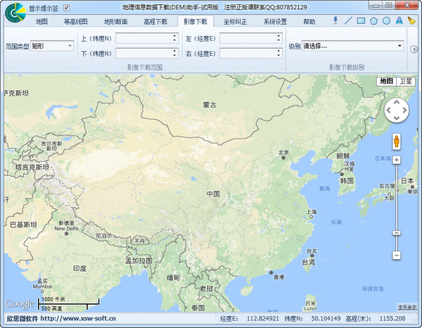
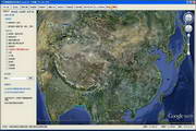
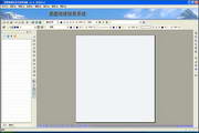
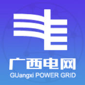
GIS software Geographic information system software, Valley Geographic Information System is an application software developed based on the Google Earth API. It is designed to expand the application of Google Earth, assist in obtaining data, and improve work efficiency. It can be used in academic scientific research, engineering, planning, design and other work, and is widely used in fields such as surveying and mapping, geology, transportation, electric power, water conservancy, agriculture, forestry, energy and tourism. Want to learn more about GIS software? Want to know which software is free? The editor of Huajun has compiled various geographic information system software for you, come and download it! Click to view PC software ios software Geographic Information Data Download (DEM) Assistant 2024-12-30 Astronomy and geography | 28.8M | v2017 official version View GoodyGIS Valley Geographic Information System 2024-12-25 Astronomy and geography | 4.44MB | 12.06.2901 View Yitu geographical information system stand-alone version 2024-12-23 CAD software | 46.76MB | 5.03 View Quality information system service version 2024-12-31 Utility tools | 59.5 MB | View Quality information system client version 2024-12-31 Utility tools | 44.3 MB | View Guangxi Electric Power Meteorological Comprehensive Information System 2024-12-31 weather software | 19.1 MB | 1.0.1 View Related articles Where is the mask in the computer version of the clipping - Introduction to the location of the mask in the computer version of the clipping Confidential View web version entrance - Confidential View web version online use Tutorials for using the driver wizard installation version, offline version and web version What is the difference between the deluxe version and the regular version of Steel Harvest - Introduction to the differences between the deluxe version and the regular version What is the difference between the standard version and the deluxe version of Little Nightmares 2 - Introduction to the differences between the standard version and the deluxe version Douyin speed version web version entrance_Douyin speed version web version official website login entrance_Huajun Software Park Related topics gain something Kuaishou Mall Douyin Mall Essential software for starting school University Essential Software Zone Huajun Software Park Download Center