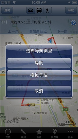
Ovi Interactive Map Browser is a map navigation software that integrates Google, Baidu, Bing and other satellite images. In addition, Ovi Interactive Map Browser also provides functions such as friend location sharing, global voice navigation, real-time traffic conditions, etc. It is an artifact for your travels and an essential tool for outdoor adventures! Huajun Software Park provides the official download address of Ovi Interactive Map Browser. Users in need should download it quickly!
Ovi interactive map browser features
1. Supports a variety of well-known maps at the same time
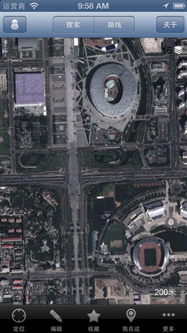
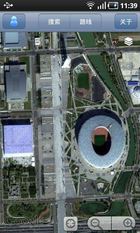
Currently, it supports Google Maps, Google Satellite Maps, Topographic Maps, Bing Satellite Maps, Opencycle high-precision contour maps, Baidu Maps, and Sogou Maps. You can freely switch between these maps to learn more detailed information. You can download these maps offline to save 3G traffic.
2. Detailed information inquiry
Route search, location search, surrounding search within a specified range, search for travel routes (supports self-driving, bus and walking), query real-time traffic conditions, comprehensive information retrieval capabilities provide guarantee for you to formulate the best travel plan.
3. Global voice navigation
You can directly perform voice navigation on the searched route, and the navigation can also display the location of your friends on the map in real time.
4. Location sharing
Tell friends your location on the map; notify friends of the map markers for gatherings; instruct others to follow the track you drew; give directions based on the real-time location of friends; share interesting places you have been to..
5. Track recording and sharing
…
6. Map planning
Draw points, lines, polygons, circles, marks, etc. on the map. Ovi Maps provides you with commonly used elements for planning and design, allowing you to do various planning and designs directly on the map. Ovie Map also provides a CAD interface that directly reads CAD design files and converts them into Ovie objects to display your designs on the map.
7. Elevation data service
Ovi Map Cloud integrates SRTM3 global elevation data, so you can quickly query the altitude of any location in the world. The elevation data service of Ovi Maps can also directly output 10-meter precision contour lines on the satellite map, allowing you to intuitively understand the altitude information when looking at the satellite map.
Only when background GPS is turned on in the application settings, it may affect battery life (off by default)
Ovi interactive map browser installation steps
1. Click on the download address provided on this website
2. Link jumps to APP store
3. Click to download and install
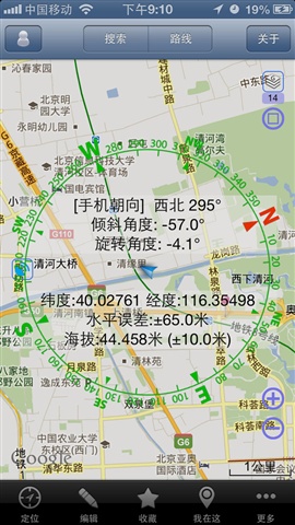
How to use the Ovi interactive map browser
1. Open the Ovi interactive map
2. Click "Edit" on the screen
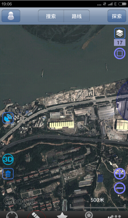
3. "Area" and "Draw Line" appear. In this step, first use the "Area" function to draw an area on the map. You can click with your hand to draw, or you can use the buttons on the screen to match the "ten" coordinates.
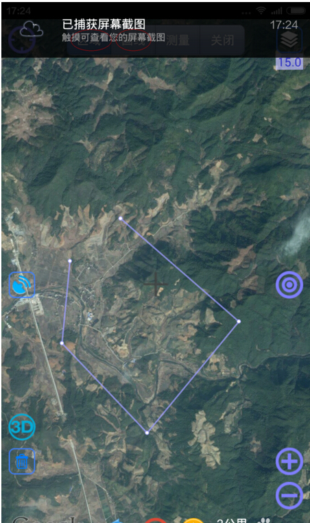
4. Draw the area as shown in the picture, and then double-click the drawn area on the screen, and the page below will appear.
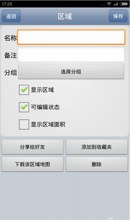
5. Then select "Download the map of the area" and the following picture will appear. In the system area, select "Suburban areas are treated the same as urban areas" so that the level will be higher and clearer, then "Click to download"

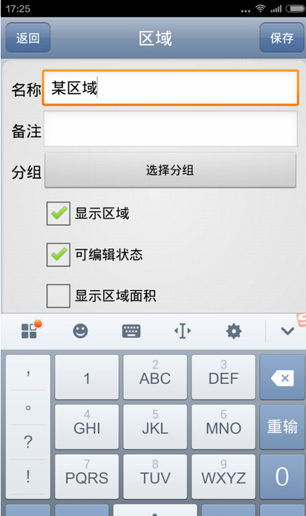
6. After downloading, you will return to the "Region" page, name the area this time, and you can save it! Download the "area" first so that you can clearly use the map offline.
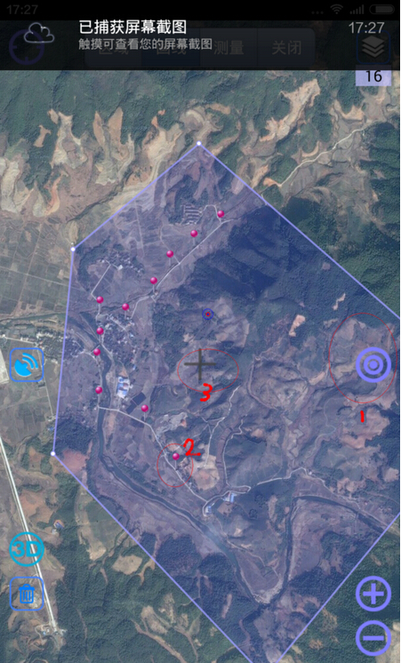
7. Enlarge the map and use the buttons "1" and "2" in the picture below to draw the mark "3" of the preliminary planned route.
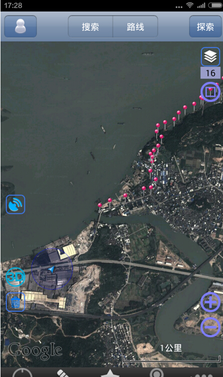
8. Finally, we got the picture below. When we go out to travel, we can turn on the GPS and go to the coordinate "3", so we won't get lost!
Ovi Interactive Map Browser FAQ
1.How to import coordinates into Ovi interactive map?
1. First, after the user opens the Ovi interactive map, search for a location through the search box or directly press and hold the location to be selected on the map.
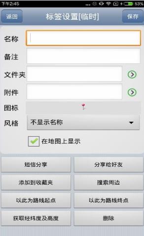
2. Then you can enter the relevant attribute settings, as shown below:
2. How to enter latitude and longitude in Ovi interactive map?
1. Enter the main map interface, click and select "More" in the navigation bar below
2. In more settings, click to enter "Select Map"
3. In the map selection page, there are many map layers to choose from. Just click on one of them, as shown in the picture; you can also "customize the map"
4. After setting up the map, return to the main interface, click Search on the main page, and enter the longitude and latitude in the search box.
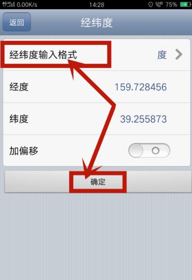
5. In the latitude and longitude page, you can set the latitude and longitude format, then modify the latitude and longitude, and click OK to locate this point, as shown in the figure.
Comparison of similar software in Ovi Interactive Map Browser
Which one is better, Ovi interactive map browser, Baidu map or Amap?
1. If you want satellite high-definition rural maps, I use Ovi Interactive Map (actually Google Maps). The whole country is very high-definition, including cities, counties and townships. Because if you use Baidu and Amap to zoom in on counties and villages, you will find that the satellite maps in counties are very blurry and are not at the same level as their satellite maps in cities.
2. In addition, Baidu’s positioning spiral direction is too floating, and the arrow points incorrectly. If you move the phone slightly, it may point in the opposite direction, but Amap is much more accurate.
3. In fact, there have been tests before. If you search for restaurants in the city, Baidu Maps is better, and Gaodeqiang for route navigation, but Gaode can generally satisfy the search requirements.
To sum up my experience of using it, it depends on where you use it most. Ovi interactive map is better when you often run on country roads. Baidu map is better only in cities. Amap is better for finding places while driving.
Ovi interactive map browser update log
1. Support new image source: Zhongke Star Chart
2. Supports simple CAD functions, which can directly open and browse CAD files in DXF format and import them into the map
3. Other bug fixes and function optimizations
Editor's recommendation
Aowei Interactive Map Browser is a cross-platform map browser based on Google API, Baidu API, and Sogou API developed by Beijing Yuanshenghuanet Company. It supports offline browsing and voice navigation of a variety of well-known maps. In addition, this website also provides downloads of Google Satellite Map, Baidu Map, Amap, Beidou Navigation, Map Positioning Master, etc.


